‘It Was Trump’: WH Official Tells WaPo President Doctored ‘Sharpiegate’ Map
President Donald Trump was the person who doctored a NOAA projection map of Hurricane Dorian to include parts of Alabama, according to an anonymous White House official: “It was Trump.”
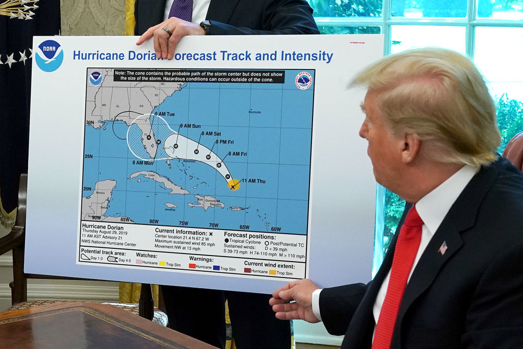
According to a new Washington Post report, “Sharpiegate,” as it’s now known, was the direct result of Trump using a marker to draw in an extra bump on a poster of an early NOAA projection of Dorian’s path through the Atlantic Ocean. Trump displayed the altered poster in a Wednesday Oval Office briefing, where he once again tried to defend his inaccurate statements from the previous weekend that warned Alabama would be impacted by the hurricane.
“It was Trump who used a black Sharpie to mark up an official National Oceanic and Atmospheric Administration map,” the Post reported, citing an unnamed White House official.
“No one else writes like that on a map with a black Sharpie,” the same White House official told the newspaper.
Notably, the president quickly claimed ignorance when asked later that day in a press availability about the provenance of the Sharpie-drawn bump on the NOAA map, interrupting the reporter before the question was even finished to say: “I don’t know, I don’t know, I don’t know.”
Several White House officials told the Post that they thought the press coverage of Trump’s false claim — and the president’s ongoing, obsessive campaign to prove otherwise — was unfair. But they acknowledged: “as long as it’s in the news, he is not going to drop it.”
Photo credit: Chip Somodevilla/Getty Images.
New: The Mediaite One-Sheet "Newsletter of Newsletters"
Your daily summary and analysis of what the many, many media newsletters are saying and reporting. Subscribe now!


Comments
↓ Scroll down for comments ↓